Skyline II Trail - Manning Park to Skagit Valley
Overview
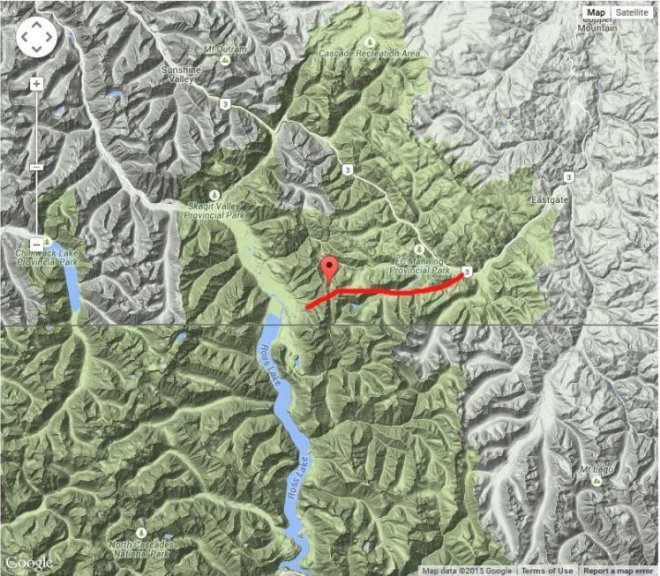
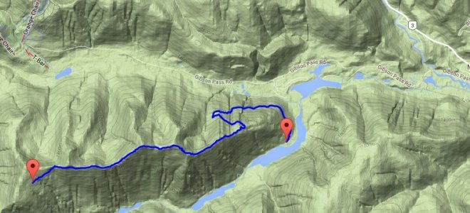
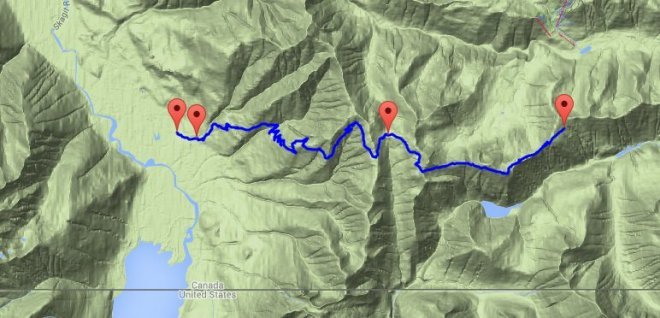
This hike is approximately 25 kilometres that takes you over a mountain range. You can do this hike by starting at either end of this trail (i.e. from Strawberry flats in Manning Park or from the Skagit Valley). Our group did this hike by starting from Strawberry flats in Manning Park. From my point of view (no pun intended), I felt it was better to do in this direction because the climb from Skagit Valley is very steep. If you're doing this hike as an over nighter with a full pack, then you might find the climb up from Skagit Valley to be quite tough.
Obviously to do this hike you will need to have a drop off and pick up vehicle. In our case, we had someone drop us off at Strawberry flats one day and then pick us up at the Skyline II trail head on the Skagit Valley side of the mountain range.
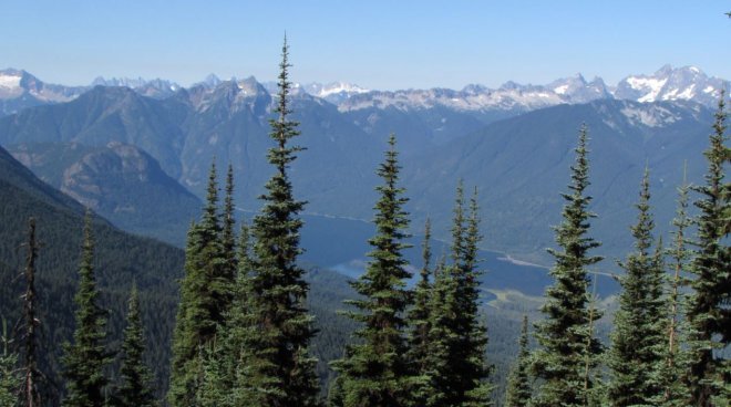
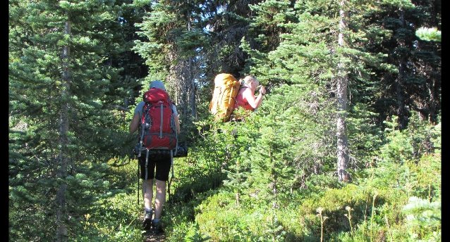
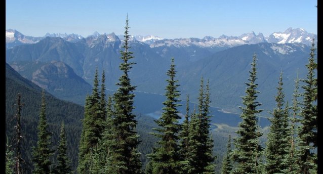
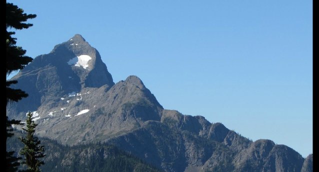
I found this to be an amazing two day hike. It was a bit of a grind to get up to the higher elevations where the mountain meadows are but, once up there, it is absolutely enjoyable with spectacular views all around.
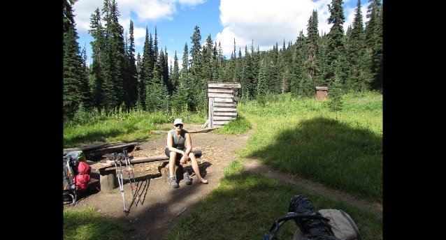
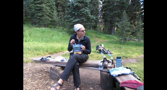
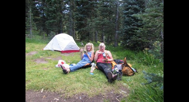
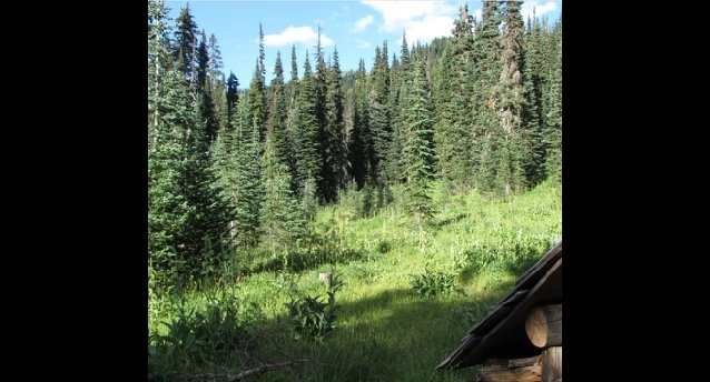
Our goal for the first day's hike was to reach Camp Mowich which is just under the half way mark of the total hike. This is a very nice camping area nestled with a flat meadow area. There are definite camping spots that are perfect for pitching a tent. Also, near the old broken down shelter, there is a fire pit area and metal bear proof cache well away from the camping area. Perfect spot really.
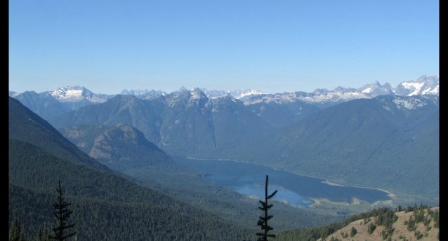
Our second day of hiking started with more climbing for a while and then things started to level off where we were treated to some more spectacular scenery including some great views of Ross lake down in the Skagit Valley. After a couple of hours we began our descent into the Skagit Valley. At first I thought that it was going to be smooth sailing with most of the hiking being down hill. However, this proved to be more gruelling than expected. Downhill hiking, in some ways can be much harder than uphill. You start to realize that you have a whole different set of muscles that are being exerted. I also think that the heat that day started to drain us. It was much hotter and completely sunny on the second day.
Also, after a couple hours of descending, this was when we began to realize that this hike would have been much more difficult if we had started from the Skagit Valley side. It's quite a steep and long ascent going this way. I would also say that, to do this hike comfortably, one should prepare by doing some strength and conditioning work prior. It's not the most difficult hike but it does require some fairly decent conditioning. That's just my opinion about this hike.
Overall, this is one hike that I would most certainly do again.
Directions and Location
If starting from Manning Park:
Take highway 3 (Crowsnest Highway) to Manning park. Turn onto Gibson Pass road. Follow this until you get to the trailhead at Strawberry flats. There are signs at the trailhead for both the Skyline I and Skyline II trails. Follow the trail until you get to a junction in the trail where Skyline II splits off from the Skyline I trail. At this junction you will start descending into a valley and the start climbing back up again. I found the trail signs to be very good.
If starting from Skagit Valley:
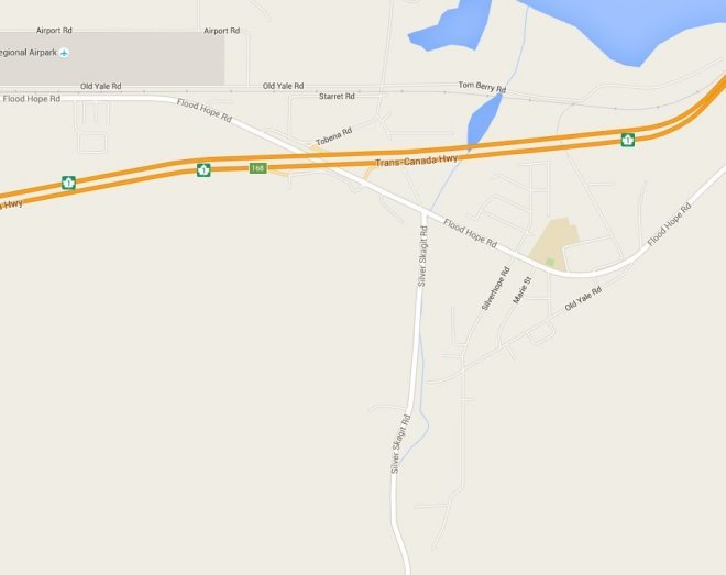
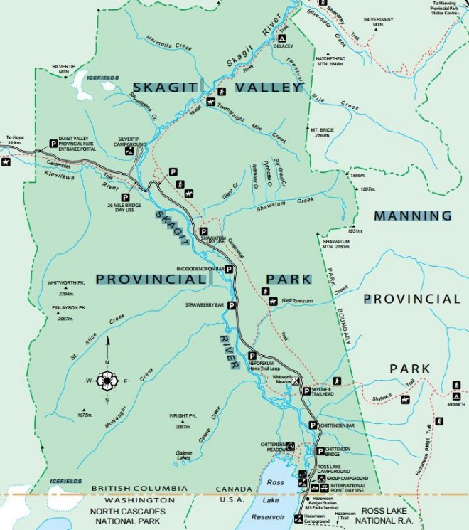
From highway 1 (Trans Canada) take the Flood Hope Rd. (exit 168) and go north on this road. After a short distance from the highway you'll reach the Silver Skagit road. Turn right onto this road (taking you North) and follow this for about 25 kilometres until you get to the a parking area on the left hand side of the road that should have a sign for the Centennial and Skyline II trailheads.